Aerial Photos
from
Pass Christian
Here are some aerial photos of the town of Pass Christian. According to figures released by the Pass Christian city government, before Katrina there were approximately 8,000 residences in the town -- after Katrina, approximately 500 were still standing and most of those are uninhabitable.
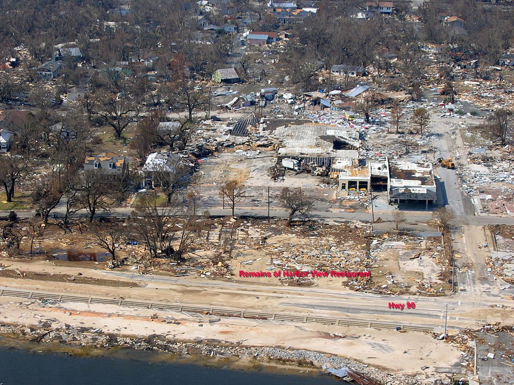
Remains of the Harbor View Restaurant, Pass Christian, MS. One of our favorite restaurants -- they had the best oyster and shrimp po' boys on the Coast. Behind the restaurant was a big antique mall, bank, offices, and much of the business section of Pass Christian.
This aerial view of Pass Christian shows a lot -- top left corner are Pass Christian High School and Middle School, both standing but gutted by flood waters. In the foreground are the remains of a Winn-Dixie supermarket and CVS Pharmacy. In the lower right corner is the remains of a luxury condo development that was under construction. In the rear of the photo, to the left of center, you see two radio towers -- these are cell phone towers that were on the property where we had most of our belongings stored -- under 20 feet of water when Katrina hit.

This is the Wal-Mart along Highway 90 between Long Beach and Pass Christian. Totally gutted -- storm surge went in the front and out the back, carrying everything with it.

| Return to Hurricane Katrina front page. |
| Photos of the house we were building. |
| Photos from Bay Saint Louis, Mississippi. |
| Photos of general destruction in the area. |
| Aerial photos of Bay Saint Louis and Waveland |